


Longueuil — The smartWhales initiative launched in by the Canadian Space Agency (CSA), in cooperation with Fisheries and Oceans Canada and Transport Canada, aimed at using satellite Earth observation data to help protect the North Atlantic right whale (NARW) in Canadian waters. This species is designated endangered and is at risk of potential vessel collisions and entanglement in fishing gear.
After three years of work, five companies developed innovative approaches to help shape a better future for the NARW that led to the creation of space-based solutions:
- ARCTUS: Satellite imagery to better understand NARW habitat
- Global Spatial Technology Solutions: Operational object-detection models for detecting and monitoring NARW with OCIANA™
- Fluvial Systems Research: Satellite observation of NARW and RADARSAT Constellation Mission detection of their feeding areas
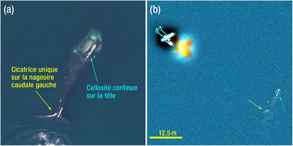
- Hatfield: Finding whales in satellite imagery automatically and quickly using artificial intelligence
- WSP Canada and DHI Water & Environment Inc.: A predictive modelling system for the enhanced protection of the NARW in the Gulf of St. Lawrence